Fault Modeling
Fault Modeling
Fault modeling uses fault surfaces to represent the spatial distribution of fault zones. Fault modeling in GES can be built by fault sticks, fault lines, fault polygon and fault points.
· Fault Modeling created by fault sticks
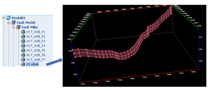
Fig. Fault pillar created by fault sticks
Steps to perform Fault Modeling (created by fault sticks) in GES:
Go to Geology & Modeling Scenario → Structure Modeling → Create Model → Input Model Name → Click OK
Go to Model pane → Click the model just created → Go to Data Pane → Faults → Fault sticks → Left click the sticks used for creating model → Right click → Create Fault Model → Settings → Click OK
· Fault Modeling created by fault lines (Fault)
Steps to perform Fault Modeling (created by fault lines) in GES:
· Go to Geology & Modeling Scenario → Structure Modeling → Create Model → Input Model Name → Click OK
· Go to Model pane → Click the model just created → Go to Data Pane → Faults → Fault lines (Fault) → Left click the sticks used for creating model → Right click → Create Fault Model → Settings → Click OK
· Fault Modeling created by fault lines (Horizon)
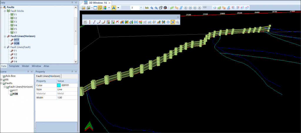
Fig. Fault pillar created by fault lines (Horizon)
Steps to perform Fault Modeling (created by fault lines) in GES:
· Go to Geology & Modeling Scenario → Structure Modeling → Create Model → Input Model Name → Click OK
· Go to Model pane → Click the model just created
· Go to Data Pane → Faults → Fault lines (Horizon) → Open a 3D window → Click one fault lines (Horizon) → Hold down shift on the keyboard → Click other fault lines (Horizon) used for creating model → drag selected fault lines (Horizon) to 3D window
· Go to Home ribbon bar → Edit Tools → Click Fault to show fault editing tools
· In 3D window, click a fault line (horizon)→ hold Ctrl on the keyboard → Click another fault polygon that belongs to the same fault surface → Click Create Fault Pillar with Polygon
· Fault Modeling created by fault points
Steps to perform Fault Modeling (created by fault points) in GES:
· Create a fault surface: Go to Home ribbon bar → Make Surface → Check Points → Select fault points used for creating fault model → Choose Boundary → Grid Settings → Algorithm Settings → Click OK
· Go to Geology & Modeling Scenario → Structure Modeling → Create Model → Input Model Name → Click OK → Go to Model pane → Click the model just created
· Go to Data Pane → Surface →Select fault surface just created →Go to Structure Modeling ribbon bar → Fault Modeling → Use Fault Surface → Click OK
Message