Property Map
Property Map
In GES, when perform reservoir map, you can set the boundary to constrain property distribution, property map can also be constrained by facies map.
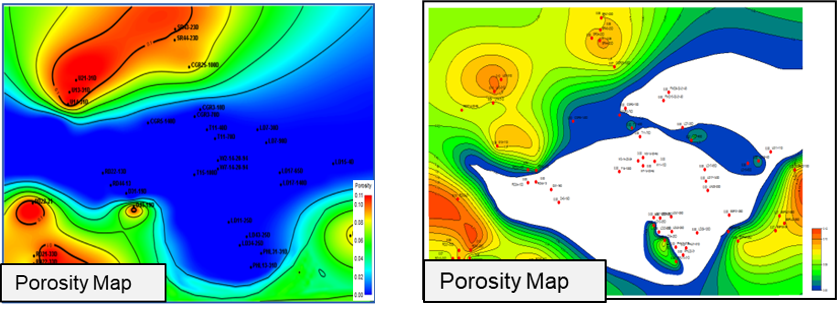
Fig. Porosity map without boundary constrain(left) and using boundary constrain(right)
Steps to perform Property Map in GES:
· Get porosity average result for zone from logs: Go to Data Pane → Click Stratigraphy→ Right Click → Click Property Calculator → Input Property Name → Select Continuous for Type → Select Stratigraphy Scheme → Choose To Zone → Select log for Log Name → Select Algorithm → Click OK
· Go to Geological Evaluation scenario/Geology & Modeling Scenario → Geology Evaluation → Porosity Map
· Select the zone → Select facies result calculated in step 1 → Click Automatic → Set Connection Radium and Source Direction → Choose Boundary → Input facies layer → Click OK
Message