Raster Log
Raster Log
Raster log module includes depth calibration, image crop, image straighten, add header and lower. The image will be compressed or extended according to the markers.
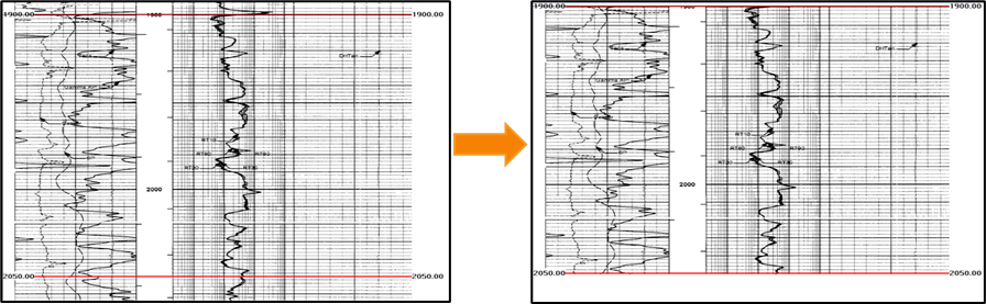
Fig. Crop at depth: before (left) and after (right)
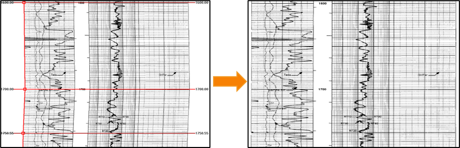
Fig. Straighten the image : before (left) and after (right)
Log digitization also can be performed in Raster Log module. In GES you can digitize log manually or automatically, and you can digitize curve in linear type or in logarithmic type.
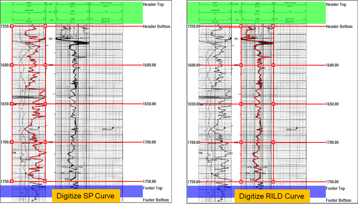
Fig. Log digitization: line type (left) and logarithmic type (right)
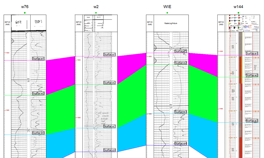
Fig. Raster log application in well correlation
Steps to perform Raster Log in GES:
· Go to Geological Evaluation Scenario/Geology & Modeling Scenario → Log Analysis → Log Digitization
· Select a well → Click OK → Load Image from computer/Project
· Click Depth Settings to set image unit → Click Add Depth to add top and bottom depth → set interpolate
· Add Straight Edge → click along the image edge → Move the square edit point to make sure the straight line are aligned with image edge → Straighten Image
· Click Digitize Logs → Click Settings to set curve name and scale → Add Track Edge (L)/(R) → Click Start → Click in the window to draw curve → Store Curve
Message