Structure Updating
Structure Updating
The structure model local updating allows for a local update on horizon model, which alters grids as well. The input for structure model local updating includes well picks, point, line and surface data, fault polygons, and model boundary. Users may define the local update boundary by using a polygon; GES could also automatically identify the update boundary from the input data.
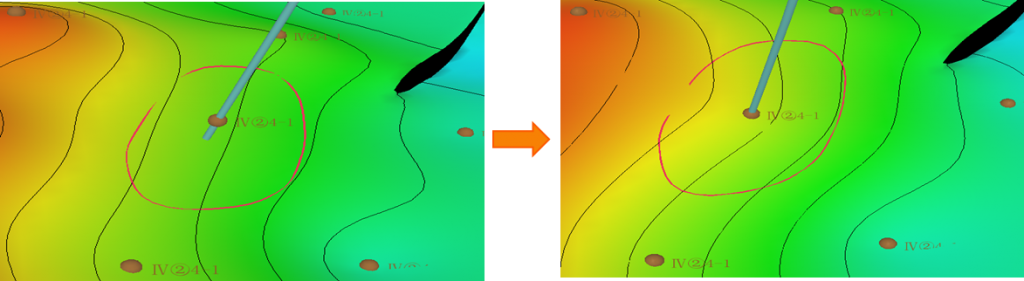
Fig. Structure map before updating (left) and structure map after updating
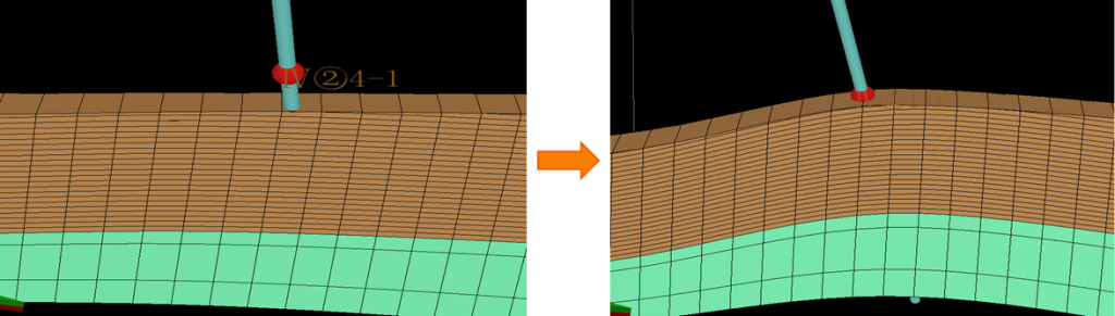
Fig. Grid model before updating (left) and grid model after updating
Steps to perform Structure Updating in GES:
· Go to Model pane → Click the model grid you want to updating
· Go to Geology & Modeling Scenario → Structure Modeling → Local Updating
· General Settings → Select data for Well Picks → Select data for Lines → Well Adjustment Settings → Regions Settings → Fault Lines Settings → Click OK
Message