Layering
Layering
After subzone modeling, the target model only have one layer for each zone, which cannot appropriately describe the heterogeneity of a reservoir. Therefore, creating layers in each zone is important. There are 4 layering methods:
• Number of Layers: Number of layers for each zone. The thickness of each layer belonging to the same zone is the same.
• Proportion: Define the individual percentage of layer thickness to the zone thickness. For example, 1,2,1 means there will be 3 layers, and the middle layer has a thickness twice as large as the top and base layers.
• From Top: Define the thickness of layers. From top to base, the software creates layers with the same thickness.
• From Base: Define the thickness of layers. From base to top, the software creates layers with the same thickness.
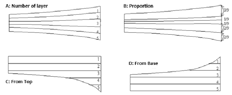
Fig. Visualization of layering methods
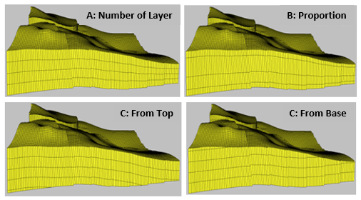
Fig. Examples of layering methods
Steps to perform Subzone Modeling in GES:
· Finish Fault Modeling, CornerPoint Gridding, Horizon Modeling and subzone modeling
· Go to Model pane → Click the grid just created → Click Horizon Modeling on Structure Modeling ribbon Bar → Select Layering Method → set Number for each method according to Method Description → Click Layering
Message