GES Modules
Facies Modeling
Block Wells
The grids created in structure modeling describe the structure features of a certain geologic body. Property modeling is to assign each grid with property value(s), and depict reservoir heterogeneity. In order to do that, users first need to assign grids that are penetrated by well trajectory with a property value (facies, porosity, permeability, water saturation, etc.). This process is known as creating Block Wells in GES.
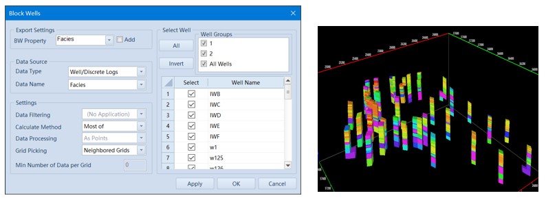
Fig. Block well interface (left) and porosity block wells result
Steps to perform Block Wells in GES:
· Go to Model pane → Click the model grid you want to updating
· Go to Geology & Modeling Scenario → Reservoir Modeling → Block Wells
· Select Data Type and Data Name → Settings → Select → Click OK
Facies Modeling
Facies modeling is to analysis the facies and sand distribution in plane, users can use trend surface, 3D trend to control facies distribution, and GES provide 4 algorithms, including Indicator Kriging, Sequential Indicator Simulation, Truncated Gaussian Simulation and Assign Value.
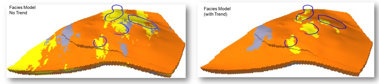
Fig. Facies Model with no trend (left) and facies model with trend (right)
When you select Variogram Analysis in Facies Modeling, the bellow window will be displayed. The window contains Variogram Analysis (upper pane) and Focused Experimental Variogram Settings (lower pane). Users may adjust the parameters above based upon geological understanding. Then users will need to adjust the parameters of focused experimental variogram.
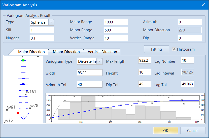
Fig. Variogram analysis interface
In Sequential Indicator Simulation, it is not uncommon to see facies ‘noise’ (grids with isolated facies). GES offers Reduce Noise tool to minimize such occurrence.
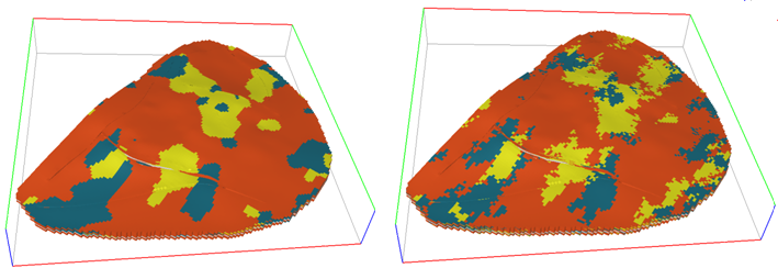
Fig. Variogram analysis interface
Steps to perform Facies Modeling in GES:
· Go to Model pane → Click the model grid you want to updating
· Go to Geology & Modeling Scenario → Reservoir Modeling → Block Wells →Finish block well
· Go to Geology & Modeling Scenario → Reservoir Modeling → Facies Modeling → Select data for BW Property Name → select Algorithm for each zone → Model Parameter → Variogram Analysis → Algorithm Parameter → Click OK